7 Days kilimanjaro- Machame circuit

Duration
7 days
Max People
20
Min Age
2+
Pickup
Airport
7 Days kilimanjaro- Machame circuit
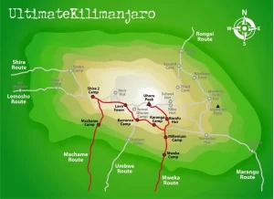
The Machame route is nicknamed the ‘Whiskey Route’ as it is considered more difficult than the ‘Coca Cola Route’, the nickname for the Marangu route. In reality, it is not more technically difficult but is longer and in places steeper. The longer distance and the opportunity to ‘walk high, sleep low’ offer much better acclimatization and as a result a very high success rate.
Included/Excluded
- Driver Guide
- Private Transport
- Entrance fees
- 1 Liter water per person per day
- Air Tickets
- Insurance
- Personal Expenses
- Meals and drinks
Tour Plan
- Arrive at Kilimanjaro International Airport (JRO) or Moshi Town
- Private transfer to your hotel.
- Dinner. Overnight
- Breakfast
- Meet your team /briefing and check of equipments.
- 1 hour Drive to Machame Gate. Check in
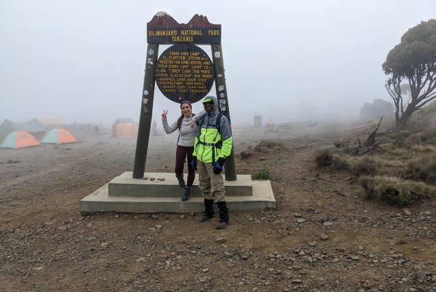
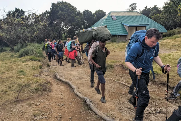
- Trek Machame Gate (1,640 meters). . On the way you will get to see subsistence farming and the town of Machame. The first day trek on the Machame Route is a long one (~11km / 7miles) and takes approximately 5-7 hours to complete.
- We mostly supply packed lunch for this route and 2-3 litres of bottled water.
- This is the only bottled water you will receive. From here on porters will collect water from mountain streams.
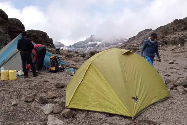
- The day’s trekking ends at Machame Camp (2,835 meters) which sits near the border of the rainforest zone and the low alpine zone. By the time you arrive your porters will have already setup your camp and tents.
Dinner. Overnight at Machame camp
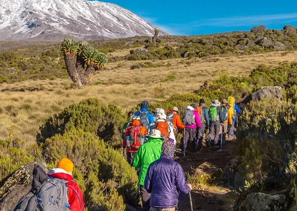
On day two you will rise early, pack your gear and prepare for the trek from Machame Camp to Shira Camp 2 (3,850 meters). The trek is relatively steep as you enter the low alpine zone which is characterized by moorlands and grasslands. Shira Camp 2 sits on a plateau which provides you with the first views of Kibo in the North-West and Mount Meru in the East. Day two takes approximately 4-6 hours and covers a distance of 5km / 3miles.
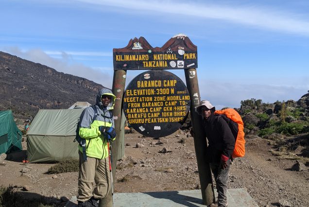
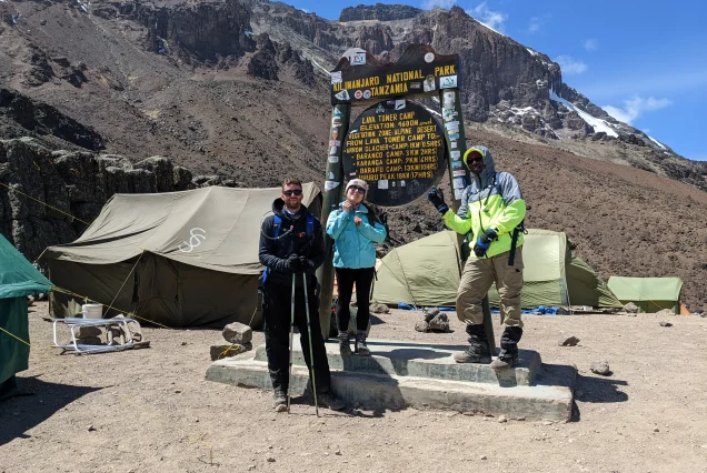
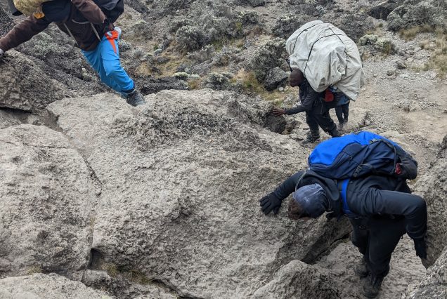
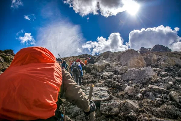
Day three is a long and tough trek east off the Shira Plateau through the ‘Garden of the Senecios’, up to Lava Tower and the Shark’s Tooth rock formation at 4,600 meters and then back down via the Southern Circuit to Barranco Camp (3,900 meters). After lunch we will descend to Barranco Camp, following the ‘walk high, sleep low’ golden rule of acclimatization. Our descent to Barranco Camp takes about 2 hours and offers great opportunities to take some beautiful photographs of the Western Breach and Breach Wall. The route is approximately 11km / 7 miles in length and takes 5-7 hours to complete.
Elevation Gain: 710 metres / 2,300 feet
Elevation Gain: 700 metres / 2,250 feet
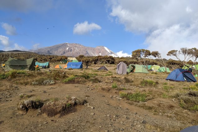
A short, but fun, day starting with a scramble to the top of the Great Barranco Wall. We then traverse over scree to the Karanga Valley (3930m) beneath the icefalls of the Heim, Kersten and Decken Glaciers. We will stay overnight at Karanga campsite. This is a shorter day meant for acclimatization.
Elevation Gain: 350 metres / 1,150 feet
Elevation Loss: 250 metres / 820 feet
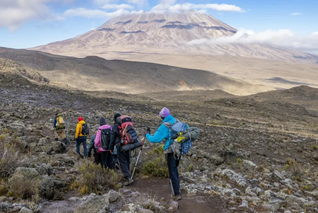
We leave Karanga and hit the junction which connects with the Mweka Trail. We continue up to the rocky section to Barafu Hut. At this point, you have completed the Southern Circuit, which offers views of the summit from many different angles. Here we make camp, rest and enjoy an early dinner to prepare for the summit day. The two peaks of Mawenzi and Kibo are viewable from this position.
Elevation Gain: 650 metres / 2,150 feet
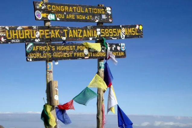
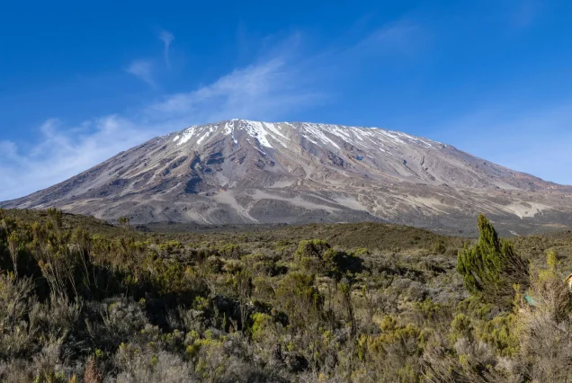
ery early in the morning (around midnight), we begin our push to the summit. This is the most mentally and physically challenging portion of the trek. The wind and cold at this elevation and time of day can be extreme. We ascend in the darkness for several hours while taking frequent, but short, breaks. Near Stella Point (18,900 ft), you will be rewarded with the most magnificent sunrise you are ever likely to see coming over Mawenzi Peak. Finally, we arrive at Uhuru Peak- the highest point on Mount Kilimanjaro and the continent of Africa.
From the summit, we now make our descent continuing straight down to the Mweka Hut camp site, stopping at Barafu for lunch. The trail is very rocky and can be quite hard on the knees; trekking poles are helpful. Mweka Camp is situated in the upper forest and mist, or rain can be expected in the late afternoon. Later in the evening, we enjoy our last dinner on the mountain and a well-earned sleep.
12-14 hours
Elevation Gain: 1,295 metres / 4,200 feet
Elevation Loss: 2,785 metres / 9,100 feet
On our last day, we continue the descent to Mweka Gate and collect the summit certificates. At lower elevations, it can be wet and muddy. From the gate, we continue another hour to Mweka Village. A vehicle will meet us at Mweka Village to drive us back to the hotel in Moshi for shower and then later our driver will pick you and be transferred to Moshi at the hotel.
3-4 hours

Leave a Reply